Packery Channel Projects & Research
Monitoring Objectives and Tasks:
The Packery Channel Monitoring Program was Designed to Accomplish Two Primary Goals:
1.) Provide comprehensive analysis of seasonal change in morphology to support research-based management of the inlet system and provide guidance in the areas of:
- Navigation Safety
- Dredge Planning
- Beach Nourishment
- Wetland Boundary Issues
- Resource Preservation
2.) Gain a broader understanding of the evolution of the channel along with changes measured at the adjacent beach, nearshore and wetland as they adjust to the recently constructed inlet.
- Development of nearshore features (bypass bay, ebb shoal)
- Seasonal periodicity of shoal formation and scour
- Shoreline position change (Mustang and North Padre Island)
- Support expansion of coastal modeling tools
CBI Monitoring Observation Stations Along Packery:
 The construction of Packery Channel was officially initiated in September 2003. Research and related environmental investigations preceded the implementation of this project. This included an Environmental Impact Statement directed by the USACE.
The USACE was directed by Congress to carry out a project for ecosystem restoration and storm damage reduction at North Padre Island. This project called the “North Padre island Storm Damage Reduction and Environmental Restoration Project, Nueces County, Texas” is described on the Galveston District website.
Packery Channel Coastal Process Modeling:
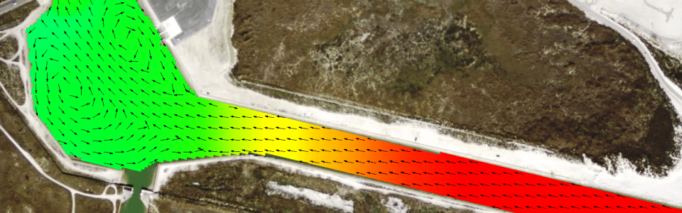
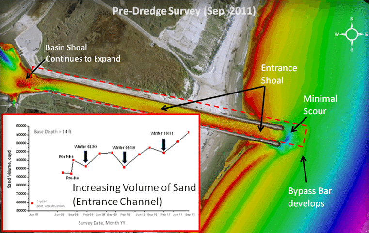
The Packery Channel Monitoring Program has generated a comprehensive data set that describes the coastal system centered at the inlet. Data and analysis describe seasonal morphologic change interpreted from detailed bathymetric data that is measured in the channel, nearshore and adjacent wetland as well as changes in the topography of the adjacent beaches and neighboring wetland. The survey data along with water current data measured in both Packery Channel and the Gulf Intracoastal Waterway are applied during model validation. CBI collaborates with the US Army Corp of Engineers, USACE to apply this data to further develop coastal modeling tools such as the Coastal Modeling Software (CMS) and GenCade, a combination of the GENESIS and Cascade models.
In addition, CBI has coupled analysis of seasonal data collected at Packery Channel with interpretation of historic aerial photography to expand predictive capacity of present models to predict wetland inundation. The Mollie Beattie Coastal Habitat Community which forms the border of the inland segment of the channel was selected as the location for development of the predictive methodology. For more information, please read Inundation Analysis Using GIS and Hydrodynamic Modeling.