
TCOON

Project Summary:
The Texas Coastal Ocean Observation Network (TCOON), is a unique network of scientific data collection platforms used to amass critical data pertaining to wind and water — essential data to anyone who lives or works near the Gulf coast. A confluence of federal, state and local governmental entities in partnership with academia, TCOON is that rare combination of tax dollars at work to provide a service that benefits all sectors of society, including commercial interests, recreational wind surfers and anglers, research scientists, and public officials responsible for environmental and public safety. The pooling of resources and funding to support TCOON reduces the financial burden of a single sponsor, while making the most of available funds.
SPONSORS
![]()
![]()
![]()
![]()
![]()
The Network:
TCOON is tasked with the collection of accurate water level data along the Texas Coast. The network currently consists of 32 data collection stations from South Padre Island, Texas to the Texas Louisiana border on the Sabine River. Many TCOON stations also measure wind data, atmospheric pressure, and air and water temperature. All TCOON data are collected using multiple data collection methods such as internet protocol devices and satellite transmitters.
THE NETWORK:
access full-screen map
Additional Info
- TCOON Sentinel Station Installation at Sabine (video)
- Presentation on Applying TCOON to Coastal Predictions (video)
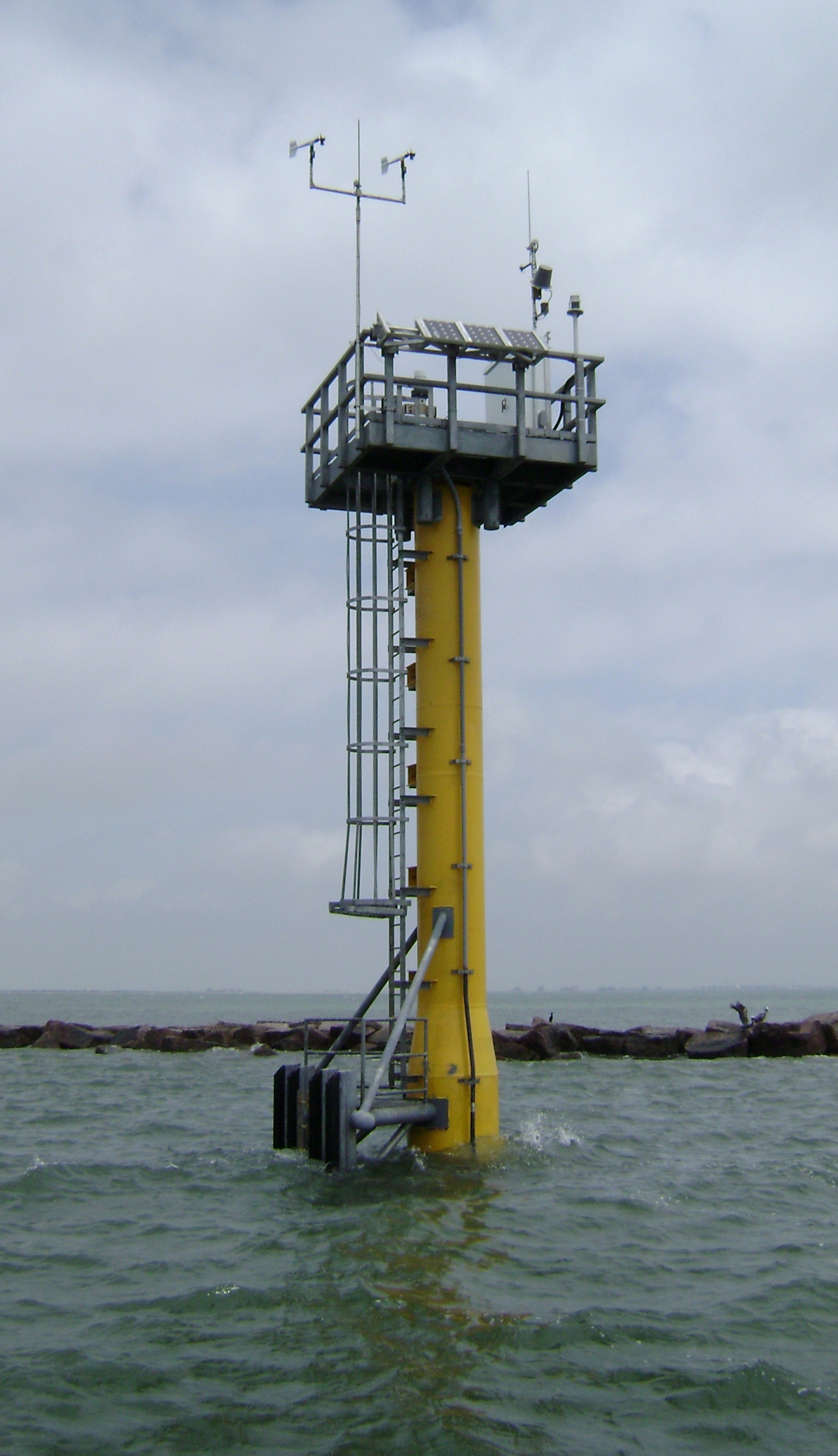
TCOON Sentinel Platform (Galveston, TX)
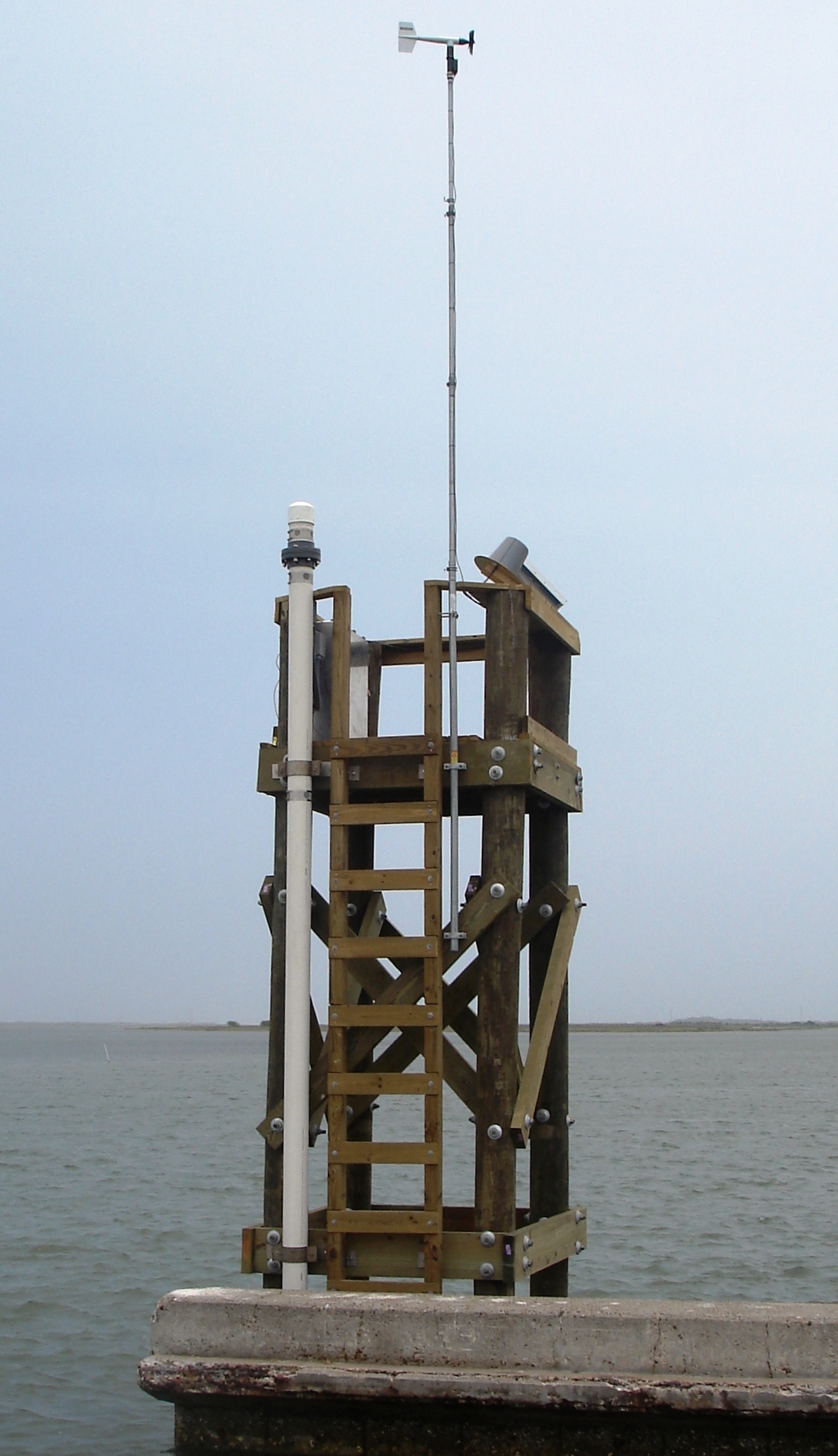
TCOON 4-Pile Platform (Packery Channel, TX)
TCOON stations are designed to meet the rigid scientific guidelines of the National Oceanic and Atmospheric Administration (NOAA) which allows TCOON data to establish tidal datums admissible in court. Tidal datums are used in identification and defense of littoral boundaries, or legal boundaries along the seashore separating privately owned land from state owned, submerged land. Moreover, detailed records provide an audit trail of all the steps used in the collection and production of data products emanating from TCOON, assuring the accuracy and reliability of these products. In addition to the critical function of the production of tidal datums, TCOON data are essential to public officials charged with hurricane preparedness, meteorologists providing storm forecasts, and research scientists monitoring the environmentally sensitive bays and estuaries along the Gulf of Mexico in Texas and as input for water level, storm surge, and circulation models.
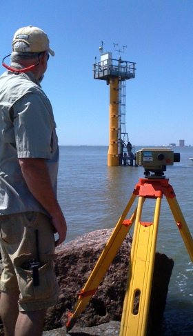
TCOON 4-Pile Platform Survey November 2012 (Matagorda City, TX)
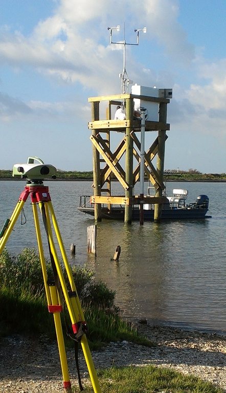
TCOON Sentinel Platform Survey August 2011 (Sabine Pass, TX)